The U.S. Environmental Protection Agency (EPA), in partnership with U.S. Army Corps of Engineers (USACE), is developing the design plans for ecosystem restoration along the concrete channel that runs through Dearborn, Allen Park and Melvindale, Michigan. Building upon the restoration work that has been ongoing for 20+ years in the area, this current initiative will continue the effort to restore the river ecosystem and environment, without diminishing the effectiveness or function of the original Federal Flood Control Project (concrete channel). This design project is funded by the Bipartisan Infrastructure Law through the framework of the Great Lakes Restoration Initiative (GLRI). The Alliance of Rouge Communities is excited to be a partner on this project within the Rouge River Watershed and is happy to host this website which will serve as a repository to:
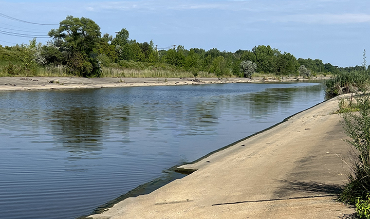
This restoration effort was chosen for its potential to improve species diversity and water quality in this section of the Rouge River by enhancing habitat alongside it and creating stream and wetland habitat. The construction of the concrete channel in the 1970s also impeded fish migration. The restoration effort aims to provide “resting areas” for fish and other species, similar to rest areas for people along a highway, as they migrate through the concrete portion of the Rouge River.
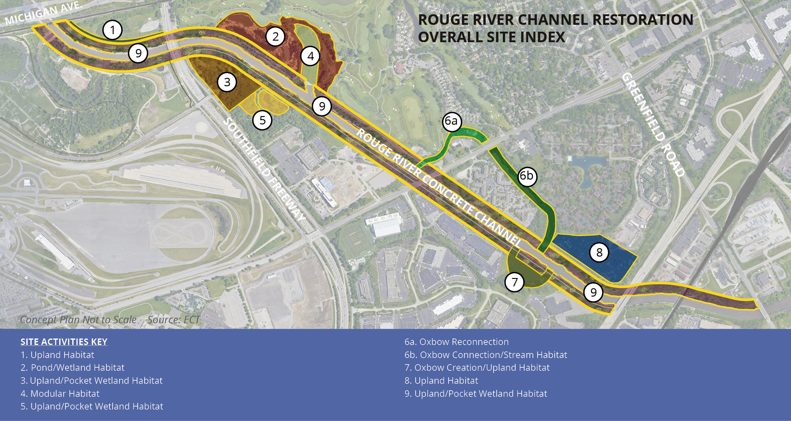
In partnership with a diverse stakeholder group, EPA and USACE are providing an opportunity to collaboratively restore an important previously neglected part of the ecosystem in southeast Michigan. The majority of the project area is on private property and the project team has begun discussions with the landowners to find possible habitat fits on their properties. The sites identified below are possible locations for these restoration activities.
Upcoming Public Meetings
KICK-OFF PUBLIC MEETING: September 4, 2024, 6:00 p.m., Dearborn Baptist Church, 16350 Rotunda Dr., Dearborn Follow along on our partners socials! Alliance of Rouge Communities, Friends of the Rouge, Friends of the Detroit River, and Wayne County Parks
Send Your Comments and Questions
Fill out our online comment card and survey Have a question, email project staff
More Information
General project flyer Photos of project sites Project site posters: Overall potential sites | Site 1 | Site 2 | Site 3 | (There is no Site 4 poster) | Site 5 | Site 6A | Site 6B | Site 7 | Site 8 | Site 9
Our Project Partners
Alliance of Rouge Communities Friends of the Rouge Friends of the Detroit River City of Dearborn City of Melvindale City of Allen Park Michigan Environment, Great Lakes and Energy (EGLE) Michigan Department of Natural Resources (MDNR) Wayne County Parks Rouge River Advisory Council (RRAC)
The Rouge River watershed covers approximately 466 square miles, encompassing 48 different municipalities. There are four major tributaries of the river (Main, Upper, Middle, and Lower) with 126 total river miles and numerous tributaries, as well as more than 400 lakes, impoundments, and ponds. The watershed is the oldest and most heavily populated and industrialized area in southeast Michigan, which has been a major contributor to its degradation. Under the Great Lakes Water Quality Agreement of 1987, the Rouge River was formally designated an Area of Concern (AOC) with nine Beneficial Use Impairments (BUIs), or types of significant environmental degradation. This project will address the Loss of Fish and Wildlife Habitat and Degradation of Fish and Wildlife Populations BUIs.
The Rouge River Flood Control Project completed by the USACE in 1978 provides flood control for southwest Detroit, Dearborn, Allen Park and Melvindale. Though hydraulically efficient, the river’s connection to adjacent habitat is severely limited, impacting biodiversity and inhibiting fish migration within the channel.
In 1998, a group of 12 local, state and federal agencies and several influential stakeholders combined forces to create a vision for sustainable development along the most downstream segment of the Rouge River, known as the “Rouge Gateway”. The Rouge Gateway Master Plan, completed in April 2001, established guidelines and an overarching vision for the restoration of wetlands, river shoreline, and fish and wildlife habitat while identifying restoration and protection potential within the Gateway corridor. This current effort is intended to act in concert with the established Rouge River Gateway Master Plan.